Professor & Head,
Cotton Research Station,
Srivilliputhur – 626 125
The River Vaippar originates at an altitude of 1644 m in Vasudevanallur Reserve forest on the eastern slopes of Western Ghats in Tirunelveli District and runs eastward for a distance of 112 km and finally empties into Gulf of Mannar near Vembar village, i.e., 18 km from Vilathkulam town of Thoothukudi District. The Vaippar river basin is located between latitude 8º 59’ N to 9º 49’ and longitude 77º 15’ E to 78º 23’ E having an area of 5423 Sq.Km and is surrounded by Tambaraparani Basin on the South Western Ghats and Vaigai Basin on the west, Gundar Basin on the North and Gulf of Mannar / Bay of Bengal on the east.
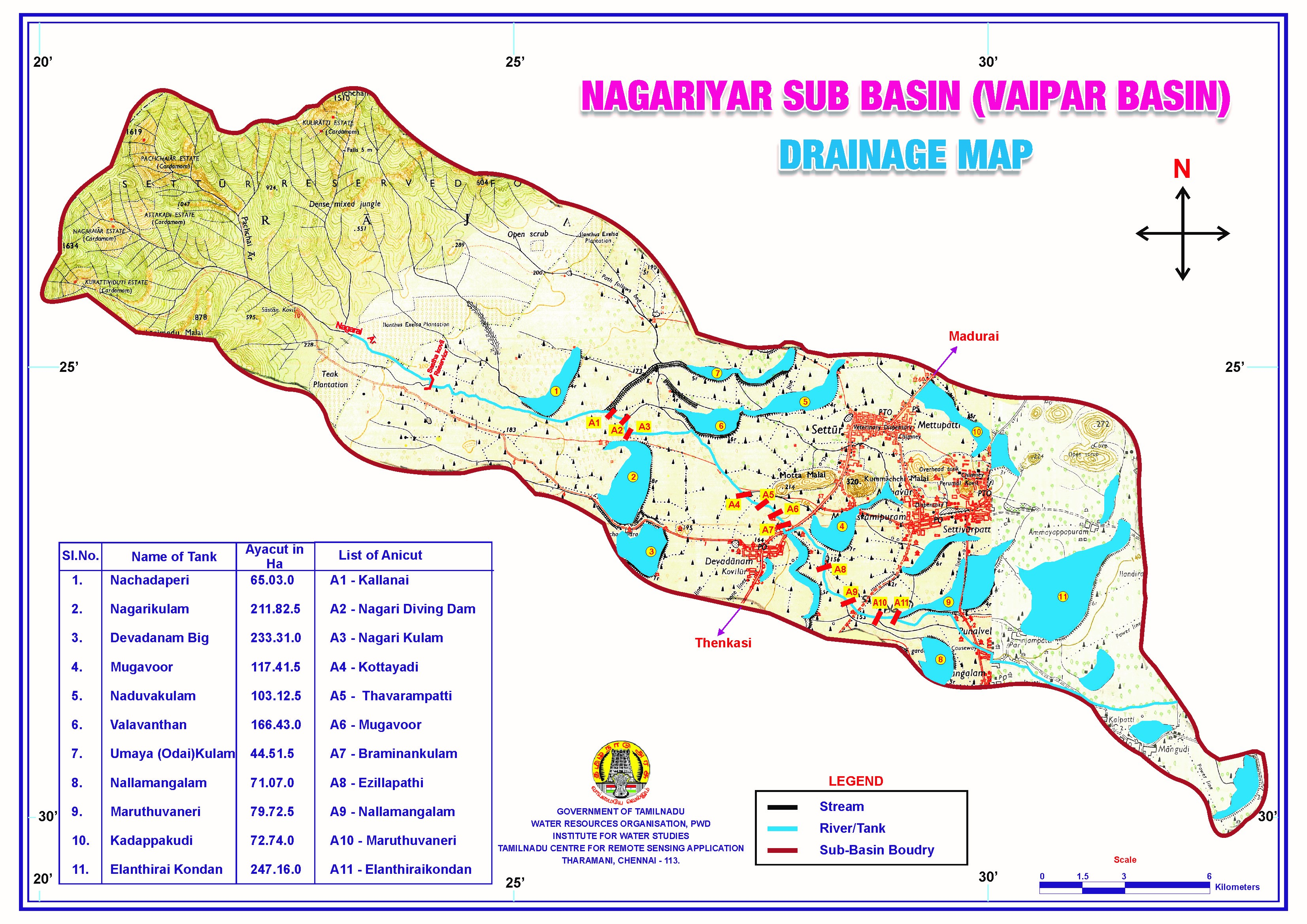
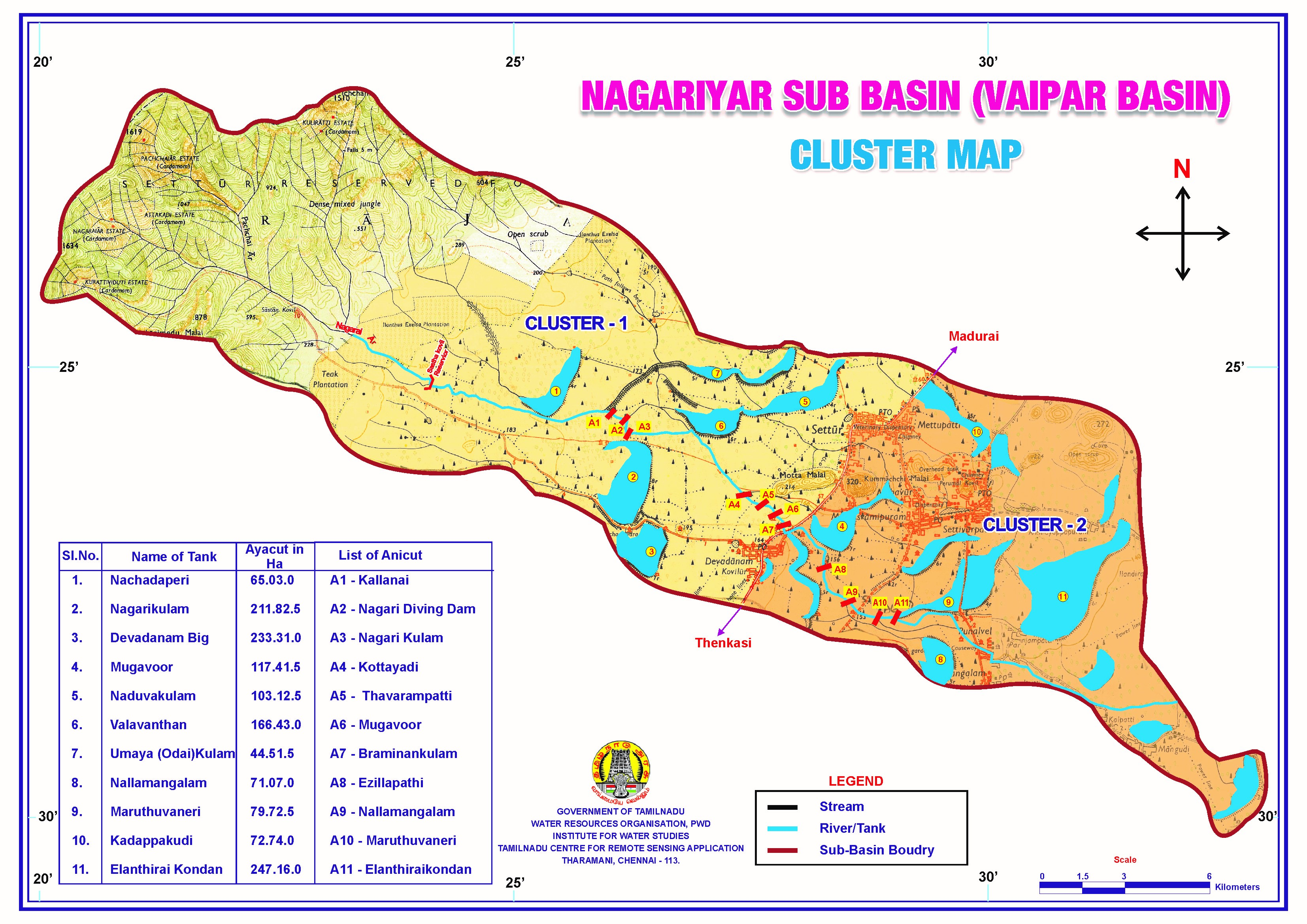
The Vaippar Basin has been divided into 13 sub basins and the Nagariyar is one part of sub basin. The Nagariyar river is a tributary to Deviyar river which in turn confluences with Nishabanadhi, the main course of Vaippar in head reach. The Basin lies in between the main sub basin of Deviyar in south and the minor sub basin in Manamakiar and Piravadaiyar in the north which comes under the sub basin of Deviyar. It originates in the eastern slope of Western Ghats at an altitude of about 1400m above MSL. Apart from above Pachaiyar is also a tributary to Nagariyar. It has got number of small streams in the reserved forest area. After passing through number of tanks the surplus falls into Deviyar.
The total catchment area of Nagariyar is 94 Sq. km. Out of which the hilly catchment area is 28 Sqkm. The basin is influenced by Sivagiri rainfall station. There are 11 No. of Anicuts across Nagariyar and as follows

In this sub basin 80.135Ha land is fed by channels as direct ayacut and there are 11 system tanks fed by this sub basin in Rajapalayam Taluk of Virudhunagar District. The registered ayacut under the tank is 1412.35Ha. There are rainfed tanks to feed 29.71Ha which is under the control of panchayat union.
S.No |
Name of the Interventions |
Yield Details (kg ha-1) |
% of increase over control |
|||||
2010-11 |
2011-12 |
Mean |
||||||
Treatment |
Control |
Treatment |
Control |
Treatment |
Control |
|||
1. |
Garden land pulses |
1453 |
1021 |
1420 |
1121 |
1437 |
1071 |
34.17 |
2. |
GM-SRI |
6952 |
5428 |
6575 |
5371 |
6764 |
5400 |
25.25 |
3. |
SRI |
6071 |
5059 |
6559 |
5482 |
6315 |
5271 |
19.80 |
4. |
IPT in RFP |
1440 |
1013 |
1077 |
941 |
1259 |
977 |
28.86 |